Pakistan Evacuates Over 150,000 as India Issues First Cross-Border Flood Warning in Months
When Waters Rise: Pakistan's Mass Evacuation Exposes Regional Climate Reality
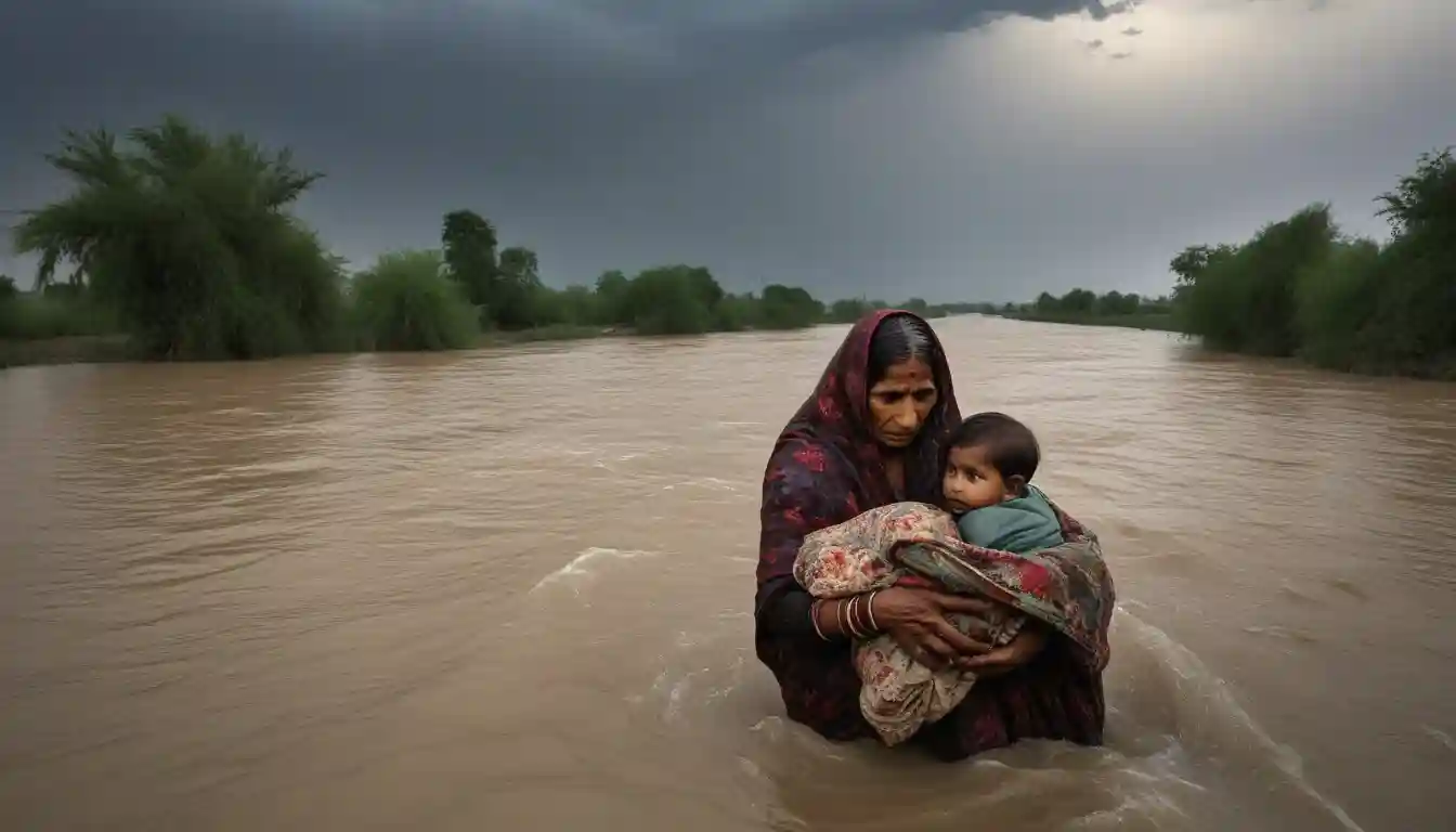
LAHORE, Pakistan — In a scene that has become devastatingly familiar across South Asia, hundreds of relief camps dot the landscape of Punjab province as Pakistan orchestrates one of its largest civilian evacuations in recent memory. Over 150,000 people—with estimates reaching beyond 200,000—have been relocated from riverine communities following an unprecedented diplomatic alert from India about imminent cross-border flooding.

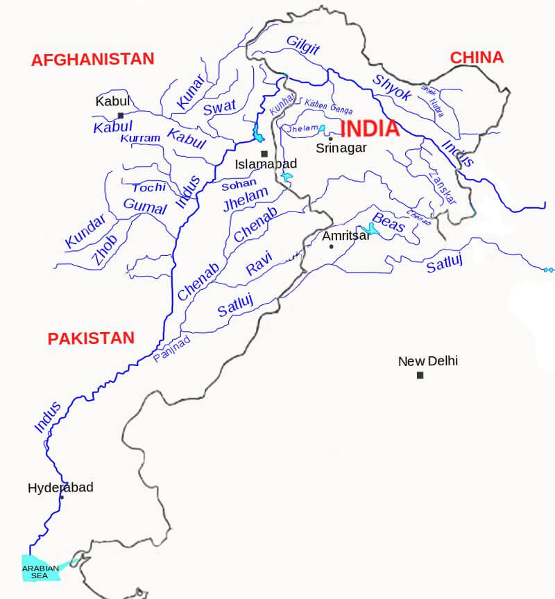
The emergency unfolded with stark efficiency on August 25th when India, breaking months of diplomatic silence, transmitted flood warnings through official channels rather than established water treaty mechanisms. Within hours, Pakistan's National Disaster Management Authority activated emergency protocols across Punjab's eastern districts, triggering mass evacuations along the Sutlej, Ravi, and Chenab rivers.
This crisis represents far more than seasonal flooding. It illuminates the intersection of climate volatility, aging infrastructure, and geopolitical tensions that increasingly define investment risk across South Asia's $4 trillion combined economy.
The Hydraulic Reality Behind Diplomatic Silence
The immediate trigger traces to meteorological extremes that have pushed India's upstream reservoir system to operational limits. Bhakra Dam, a cornerstone of regional water management, approached 1,672 feet—dangerously close to its 1,680-foot maximum—forcing controlled releases that transformed from routine water management into regional crisis.

"The physics here are unforgiving," noted one regional hydrology expert who requested anonymity. "When reservoirs hit capacity during extreme monsoon episodes, release protocols become matters of engineering necessity, not diplomatic choice."
The cascade effect proved swift and severe. As India's Thein Dam releases caused the Ravi River to overtop at Lakhanpur, downstream flood risks escalated across Pakistan's most agriculturally productive regions. Provincial bulletins warned of "exceptionally high" flood conditions within 48 hours, language typically reserved for once-in-a-decade events.
Pakistan's monsoon death toll, climbing above 800 fatalities since June 26th, now rivals the devastating 2022 floods that submerged one-third of the country. The human cost extends beyond immediate casualties—health facilities report surging cases of malaria, skin infections, and snake bites as displaced populations strain local medical capacity.
Monsoon-related fatalities in Pakistan, comparing the current season to the devastating 2022 floods.
| Year | Fatalities |
|---|---|
| 2023 | 788 |
| 2022 | 1,739 |
| 2010 | 1,985 |
Diplomatic Channels Crack Under Climate Pressure
The decision to transmit flood warnings through diplomatic rather than technical channels exposes deeper fractures in regional water governance. For months, official contact between the nuclear-armed neighbors had been suspended following security incidents and reciprocal strikes earlier this year.
India's choice to bypass the Permanent Indus Commission—the binational body established under the 1960 Indus Waters Treaty—signals both pragmatic crisis management and institutional breakdown. The diplomatic alert, framed as humanitarian necessity, represents the first publicly acknowledged official contact in months.
Water management experts express concern about precedent-setting implications. "Operating outside established treaty mechanisms during climate emergencies creates dangerous ad-hocism," observed one former water diplomat. "Just as we need institutional coordination most, we're witnessing its erosion."
The Indus Waters Treaty is a water-sharing agreement signed in 1960 between India and Pakistan. It allocates the waters of the Indus River system, granting India control over the three eastern rivers (Ravi, Beas, Sutlej) and Pakistan control over the three western rivers (Indus, Jhelum, Chenab).
The Indus Waters Treaty, governing river management between the nations for over six decades, allocates eastern rivers (Ravi, Sutlej, Beas) to India while assigning western rivers (Jhelum, Chenab, Indus) to Pakistan. This division adds complex sensitivity to upstream release decisions during extreme weather events.

Economic Calculus of Climate Disruption
The evacuation's economic implications extend far beyond immediate humanitarian costs. Punjab's kharif crops—rice, cotton, sugarcane, and fodder—face significant localized losses just as global commodity markets grapple with supply volatility. Transport corridors serving regional trade face interruption, with knock-on effects across Pakistan's already strained economy.

Energy sector impacts compound the disruption. Hydropower generation fluctuates with emergency releases while embankments, bridges, and canal infrastructure face stress testing that could elevate medium-term irrigation risks. The economic geography of both nations depends heavily on Punjab's agricultural productivity, making flood damage a shared regional vulnerability.
Investment analysts tracking South Asian markets note concerning patterns. "We're seeing infrastructure stress tests occur with increasing frequency," commented one senior emerging markets specialist. "The question becomes whether institutional frameworks can adapt fast enough to manage climate-amplified volatility."
The Arithmetic of Displacement
Relief operations reveal both preparedness gains and persistent gaps. Pakistan's rapid activation of hundreds of relief camps and army assistance demonstrates improved emergency response capabilities developed through harsh experience. Rescue 1122, the provincial emergency service, reported moving over 32,500 people in coordinated operations that expanded as conditions deteriorated.
Yet displacement figures vary significantly across official sources—a variance that complicates resource allocation and reveals coordination challenges. Reuters cited approximately 150,000 evacuated while AP reported over 200,000 displaced, suggesting ongoing flux in affected populations as district-level evacuations continue.
The UN's release of emergency funds to support Pakistan's response underscores international recognition of the crisis scale. Health surveillance becomes critical as stagnant floodwater creates ideal conditions for vector-borne disease outbreaks typically emerging 10-20 days after peak flooding.
Market Intelligence: Reading Climate Risk Through Water Stress
Forward-looking investment analysis suggests several emerging themes. Regional agricultural commodity volatility appears increasingly correlated with extreme weather frequency rather than seasonal patterns. Pakistani agricultural equities, already under pressure from economic headwinds, face additional climate-driven uncertainty.
Infrastructure resilience emerges as a critical investment criterion. Companies with flood-resistant supply chains and diversified operational geography may outperform during increasingly frequent extreme weather events. Energy sector investments face dual pressures from hydropower volatility and grid stability during emergency periods.
The diplomatic dimension adds another layer of complexity. Successful crisis cooperation could catalyze broader bilateral economic engagement, particularly in climate adaptation infrastructure. Conversely, politicization of water management could fragment regional supply chains and elevate country risk premiums.
Forecasting Through the Storm
Short-term monitoring focuses on peak river levels over the next 48-72 hours, with potential secondary surges as additional dam gates undergo management. Provincial alerts warn of possible "very high" flood stages propagating downstream into early September, with particular attention on lower basin areas.
Medium-term implications center on monsoon duration. Weather patterns suggest active conditions persisting through at least September 10th, extending evacuation duration and strain on relief infrastructure. Disease surveillance becomes paramount as population displacement continues.
Climate change is profoundly impacting the South Asian monsoon, leading to more extreme weather events. This includes increased variability, with more intense rainfall episodes and longer dry spells, disrupting regional water security and agriculture.
Longer-term, this crisis accelerates pressure for institutional adaptation. Real-time cross-border flood data sharing, pre-monsoon reservoir drawdown protocols, and floodplain management reforms emerge as policy priorities. The question remains whether political frameworks can evolve to match climate reality.
Investment professionals tracking regional exposure should monitor gate operations at key upstream reservoirs, evacuation capacity metrics, and rainfall forecasts across the western Himalayan catchment. The narrative framing adopted by both governments—cooperative safety versus weaponized water—will determine whether future alerts arrive faster and more detailed, or become increasingly politicized.
As relief camps expand across Punjab's riverine districts, the broader lesson crystallizes: South Asia's economic future increasingly depends on managing climate volatility through regional cooperation, not despite political tensions. The alternative—crisis-driven diplomacy amid humanitarian emergency—offers neither stability nor prosperity for the subcontinent's 1.8 billion people.
Past performance of weather patterns does not guarantee future results. Investors should consult qualified professionals before making decisions based on climate risk analysis.